This is the second article in a series on a visit to the Port Imperial Circuit from Manhattan’s Grand Central Station, you can follow ‘F1 in America’ on twitter and Facebook for regular updates on this story and more photographs.
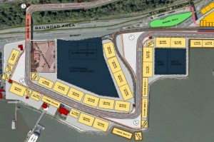
Just before I visited the circuit in May, Jalopnik leaked a revised circuit diagram which included a few changes from the initial layout last year, virtually identical to the one my contact at Tilke brought to our meeting. At the end of Part 1 of this article, the most recent public version of the entire circuit map (.pdf) is available. Both versions are shown below highlighting changes to the pit out and waterfront section through turns 2, 3 and 4 that were made between 2011 and May 2012. Click on any of the images in this post to zoom.
Turns 1 -4 of the Port Imperial Circuit: Initial layout (Fall 2011)
Turns 1 -4 of the Port Imperial Circuit: Updated layout (May 2012)
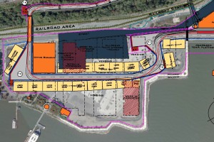
Noting these differences before my trip to the circuit, I asked my friend at Tilke what brought these about, and part of the reason for these changes include a need to slow race traffic towards turn 4, a 90 degree right hander with no runoff area. By creating a slower 90 degree right at T3, cars will be forced to reduce speed entering and exiting as they head back up the hill to T4. Pit out has also been shortened to exit closer to Turn 1, and a decreased length between T1 and T2 will mean that the speed differential between cars re-entering the circuit there is also lessened.
Turns 1 and 2 are currently a 90 degree left and sweeping exit right hander over private land (mostly parking lots) which will be surrounded by grandstands, and FOM cameras covering the race will no doubt aim to include cars, spectators and the impressive skyline as drivers come through this part of the circuit. Below is the view out of 3 up the hill towards a bridge which crosses over the Southern end of passenger rail line to the circuit. This is a narrow two lane stretch with homes very close by on driver’s right, and from the looks of it will need some work as the transition to the concrete portion is currently uneven:
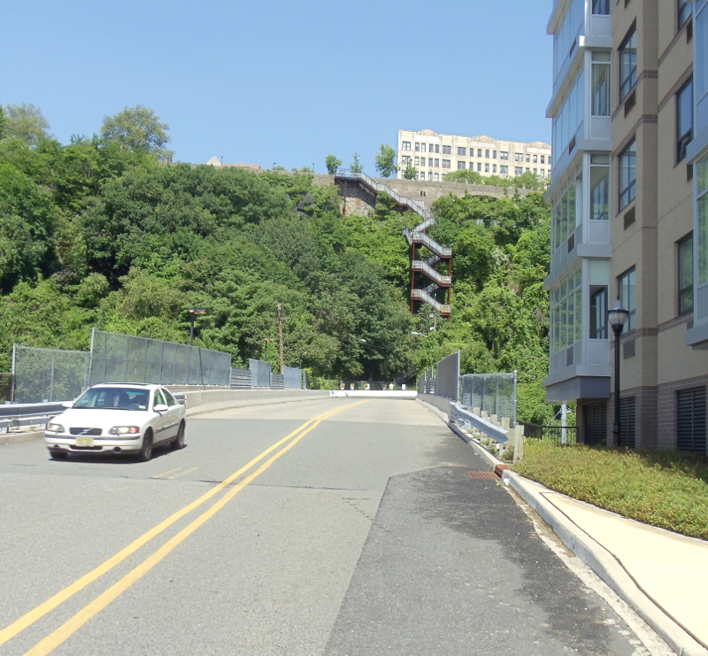
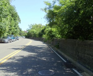
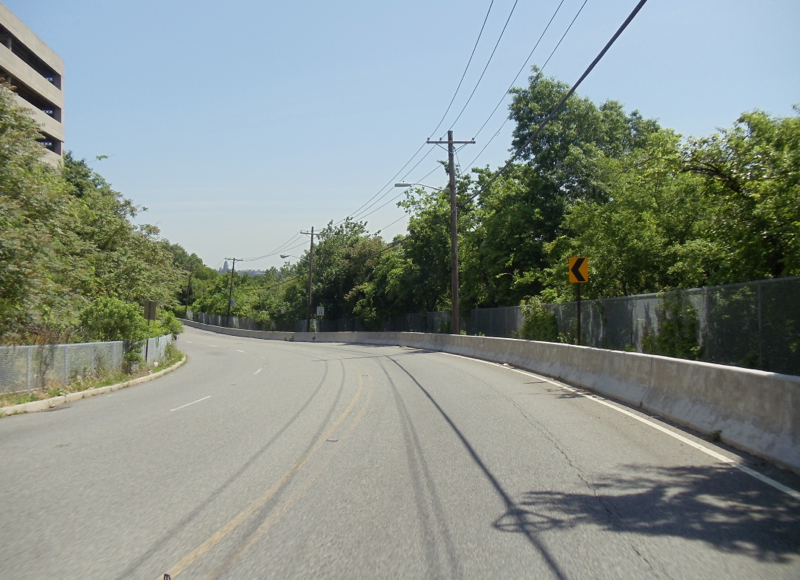
Across the other side of the bridge at T4, a tight 90 degree right, the circuit gains most of it’s elevation along Pershing Road, running just over two lanes wide with speed bumps along it’s length.
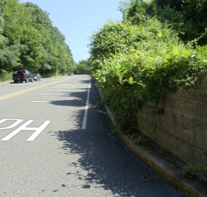
Trees also line both sides, with shadows cast along the East side of Pershing road in late morning sun. Things like storm drains and manhole covers (below) are usual road features that may or may not be on the racing surface, depending on how asphalt and track wall are put down to define the course.
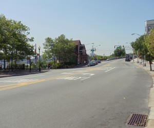
Approaching the top of Pershing road, a restaurant (far R) sits at the intersection where a wider JFK Blvd East contours along the cliffside offering an overtaking spot with a view for television cameras:

Cars will be exiting their climb up the hill here onto the longest straight of the circuit with a quick left/right chicane onto JFK Blvd East. Judging from F1 speeds at places like Piscine at Monaco, and with a fairly forgiving camber along the road, cars will be passing through here well over 100 mph. The photo below shows a good amount of usable area for track width at this exit for overtaking. Beyond the traffic lights on the right will be a slip road probably for course safety and track services.
Camber will be an issue along this circuit, and one of the changes that Tilke has specified is a lessening of the road’s crown or curved raised center profile, something most roads have to some degree to help remove standing water and aid in drainage. The view below is back in the race direction a little farther along JFK Blvd East, and shows parked cars angled away from each other due to the degree of camber in the road that currently exists.
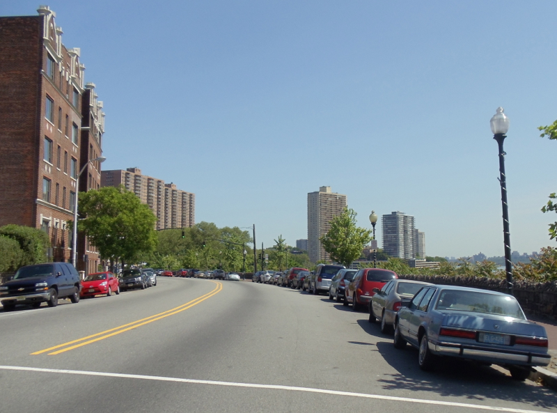
Tilke’s Formula 1 driving surfaces are known for their billiard table smoothness (the purpose built road course at Circuit of The Americas is specified to be flat within 2mm over a 4m distance), a trait that helps keep F1 cars’ aerodynamic grip consistent along the road. However, because these are public roads in use year round, some crowning will be needed. Rain in this area can fall at more than an inch per hour and over extended periods in hurricane season so good drainage is important. It’s expected that some of the earliest road work to begin at Port Imperial will take place in the form of millwork on JFK drive in preparation for resurfacing and a reduction in the road’s crowning.
Winding along JFK at the top of the hill are just over ½ mile of homes, trees, public parks, and a series of gently sweeping turns overlooking the magnificent Manhattan Skyline. The view towards New York is breathtaking, and top speeds here may reach 200 mph as cars outbrake each other beside this public park and fountain. Grandstands are currently planned to capture the action for fans.

Critical to the success of any street circuit is the area available to overtake using the existing road layout, and it’s along the fastest portion of the circuit that once again the road widens as cars prepare for the trip back downhill along Anthony M. Defino way.

The road narrows slightly here as the cars head down this flowing hill towards the hairpin, dropping back down 150’ in a just over ½ mile.
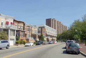
The next photo of the approach to the hairpin reveals the tall Versailles Apartments and Galaxy Towers behind a row of tan homes in the foreground that are situated between Anthony M. Defino Way and a retaining wall. Residences directly affected by the race will be an important part of planning for Grand Prix organizers, as homes and businesses affected by the circuit are an important part of the work behind the scenes to make a race like this successful.
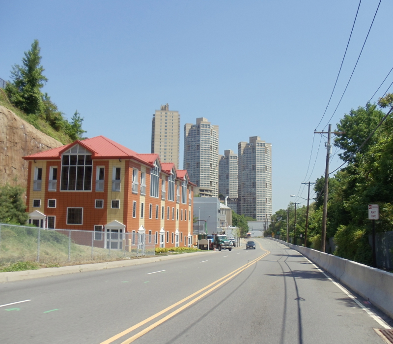
Buildings like those in the foreground above can be completely barricaded during various phases of circuit operations – in this case literally between a rock and a hard place. Paving equipment, catch fencing and concrete barriers have to be scheduled to arrive and depart in the coming year along the only road in or out of buildings like these, so altering or limiting the entrance to homes and businesses during these various phases requires careful planning and consideration not only for residents, but also for emergency services (police, private security, fire, EMS), deliveries and visitors.
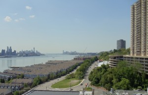
Not all homes will be affected the same way by the arrival of the circuit, as this view above from the Galaxy Towers looking South over the hairpin shows. Part of the race’s economic impact will certainly be felt here with balconies commanding top dollar for their impressive views. The Versailles Apartments are on the right, and between these two sets of buildings, some owners will be thinking about the vistas they’ll be able to rent or share come race weekend.

Back down on the ground, the panoramic shot above shows a gentle slope into the hairpin as well as the space circuit designers have to work with at this critical braking and overtaking area. Roughly equivalent in total area to a football field, this turn has much more room than the hotel hairpin at Monaco, with plenty to create track width and overtaking. Recent plans call for a statue to be located roughly where this photo is taken on the grass, a nice touch that recalls memories of the Long Beach circuit.
Part 3 is an interactive map of the circuit with the photos above located along a Google map for easy location – for more photos of this visit and updates, visit F1 in America on Facebook and twitter @F1US.



[…] My next post will cover the drive up the hill, and challenges Tilke’s engineers face with creating a usable public road surface and Formula 1 race track. (Part 2 here) To get more familiar with the circuit, here’s a copy of the complete layout (.pdf) that you can also download: […]
What are the odds that Bernie will leverage this race in an attempt to get more money out of Montreal. I just can’t imagine F1 having 3 North American races on an ongoing basis.
And with Carlos Slim lobbying for a race in Mexico, we’ll have 4 races all vying for spots on the calendar. Somebody’s going to get the axe, and it’s probably going to be Canada.